More than 2 years after Sandy, serious problems remain
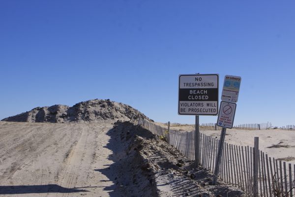
beach is closed at the Christie Sea Wall Folly. The politicians don’t want you to see the mess they’ve made of the beach. (Mantoloking, NJ – 1/17/15)
A cloudless crisp 25 degree January Saturday morning prompted the dog and I to take a trip to check out the shore – what we saw:
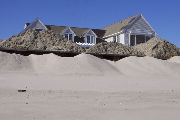
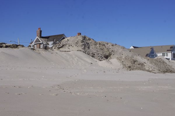
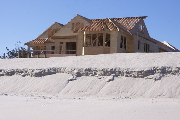
Driving over the ridge of the Rt. 528 bridge and coming down into Mantoloking, looking out towards the beach, we were jarred by a huge ugly scar along the oceanfront – the King Canute $40 million Seawall (photo above).
As we wrote (see: Christie’s Sea Wall Follies:
“Here is what Gov. Christie’s own Hazard Mitigation Plan says about sea walls – they don’t work and make erosion problems worse:
Historically, some of the methods used by municipalities and property owners to stop or slow down coastal erosion or shoreline change have actually exacerbated the problem. Attempting to halt the natural process of erosion with shore parallel or perpendicular structures such as seawalls (groins and jetties) and other hard structures typically worsens the erosion in front of the structure (i.e. walls), prevents or starves any sediment behind the structure (groins) from supplying down-drift properties with sediment, and subjects down-drift beaches to increased erosion. Since most sediment transport associated with erosion and longshore drift has been reduced, some of the State’s greatest assets and attractions – beaches, dunes, barrier beaches, salt marshes, and estuaries – are threatened and will slowly disappear as the sediment sources that feed and sustain them are eliminated.
Sandy barrier/bluff coastlines are constantly changing as the result of wind, currents, storms, and sea-level rise. Because of this, developed sandy shorelines are often stabilized with hardened structures (seawalls, bulkheads, revetments, rip-rap, gabions, and groins) to protect coastal properties from erosion. While hardened structures typically prove to be beneficial in reducing property damage, the rate of coastal erosion typically increases near stabilization structures. This increased erosion impacts natural habitats, spawning grounds, recreational activity areas, and public access (Frizzera 2011). Table 5.2-1 summarizes the number and type of NJDEP shoreline structures off the coastline of New Jersey along the Atlantic Ocean and Inland Bays (current as of 1993). (Chapter 5.2)
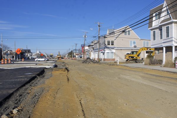
We waited at the traffic light of the intersection of Rt 35 for what seemed like 5 minutes, because the road there is still under construction and limited to one lane. And this was on a winter Saturday morning with little traffic.
As I waited, I had plenty of time to read the HUGE SIGN posted by DEP about the “resilience” sea wall project. I was reminded of the scene “Now which way do we go?” Scarecrow from the Wizard of Oz. Almost expected to see DEP Commissioner Martin do his scarecrow skit.
We parked the car by the Mantoloking Fire Station and set out for the beach, where we were assaulted by another sign: (see above photo).
Disregarding that warning, we took a stroll north along the beach to the northern tip of the sea wall, then reversed course south for about 2 miles. We especially wanted to look at the Canute Sea Wall. We spoke to a few longtime residents out for a walk on the beach.
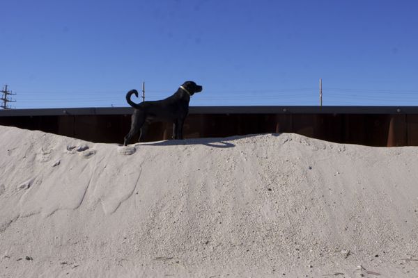
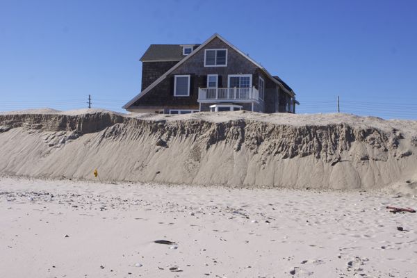
Our observations can be found in the photo captions:
- a long time 30+ year resident told us that full moon high tides and nor’easters run right up to the sea wall and wash out all the sand. “It’s pretty scary” she said.
sand at base of sea wall regularly washes out. Bulldozers constantly replace it.
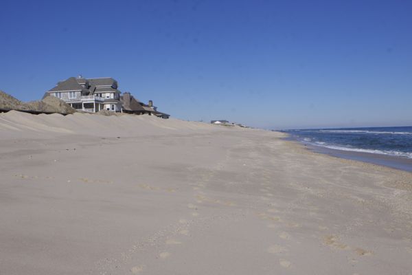
the beach was narrow, maybe 75 feet, and steeply sloping. I asked a couple out walking their dog about how badly the beach was doing. “They’ll fix it” the man replied, as If the erosion problems were simple car repair.

this is a JCP&L substation in a low lying area along Rt. 35. It is vulnerable to coastal and back bay flooding. No changes appear to have been made to reduce vulnerability.
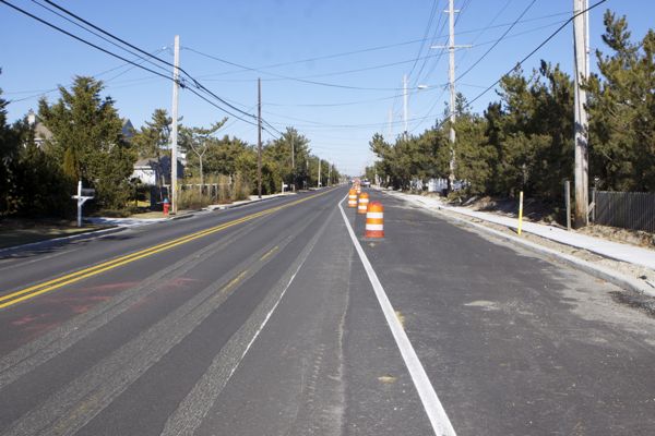
Rt 35, looking north. Where’s the bike lane? That yellow marker on the right, by the sidewalk, is a natural gas line. Those pipes are vulnerable and fed fires in wake of Sandy.
Returning to the car, we headed south to Island Beach State Park – we don’t know the Rt. 35 construction schedule, but we had assumed that there would be a full court press to get the work done before the spring season and to minimize disruption for residents and businesses. We also thought that $250 million would pay for work on Saturdays.
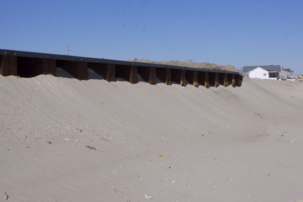
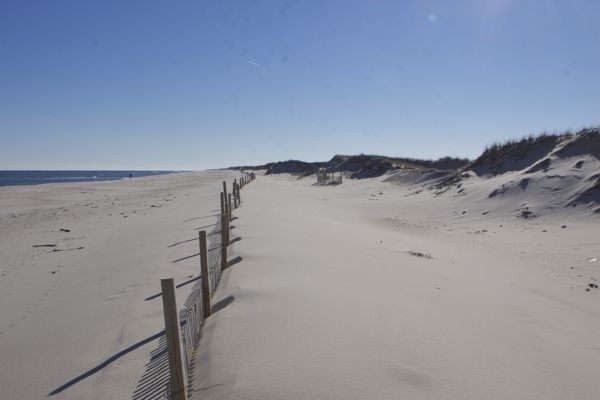
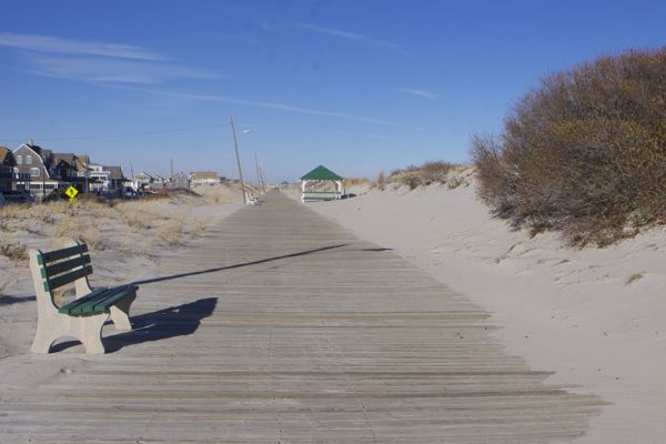
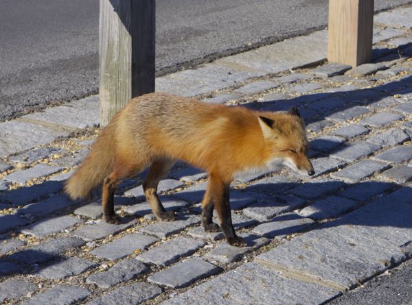
Here’s what we saw there:

Pingback: Scott Yancey
Pingback: Scott Yancey
Pingback: Scott Yancey
Pingback: Scott Yancey Review
Pingback: Scott Yancey Review
Pingback: Scott Yancey Review
Pingback: Scott Yancey Review
Pingback: Scott Yancey Review
Pingback: Scott Yancey Review
Pingback: Scott Yancey Review
Pingback: Scott Yancey
Pingback: Scott Yancey Review
Pingback: Scott Yancey Review
Pingback: Scott Yancey
Pingback: Scott Yancey Review
Pingback: Scott Yancey
Pingback: Scott Yancey
Pingback: Scott Yancey
Pingback: Scott Yancey
Pingback: Scott Yancey Review
Pingback: Scott Yancey
Pingback: Scott Yancey Review
Pingback: Scott Yancey
Pingback: Scott Yancey
Pingback: Scott Yancey
Pingback: Scott Yancey Review
Pingback: Scott Yancey
Pingback: Scott Yancey Review
Pingback: Scott Yancey
Pingback: Scott Yancey Review
Pingback: Scott Yancey Review
Pingback: Scott Yancey
Pingback: Scott Yancey
Pingback: Scott Yancey Review
Pingback: Scott Yancey
Pingback: Scott Yancey
Pingback: Scott Yancey
Pingback: Scott Yancey Review
Pingback: Scott Yancey
Pingback: Scott Yancey
Pingback: Scott Yancey Review
Pingback: Scott Yancey Review
Pingback: Scott Yancey
Pingback: Scott Yancey Review
Pingback: Scott Yancey Review
Pingback: Scott Yancey Review
Pingback: Scott Yancey Review
Pingback: Scott Yancey Review
Pingback: Scott Yancey Review
Pingback: Scott Yancey