DEP Gets Slammed At Public Hearing on Adoption of FEMA Flood Maps
FEMA Maps Underestimate Risks Due to Climate Change
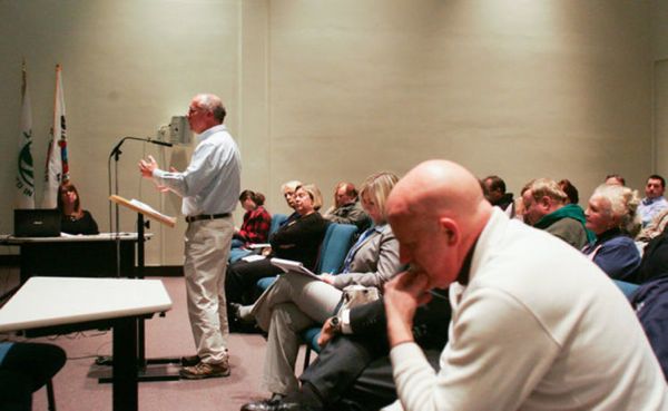
Last evening, DEP held an “after the fact” public hearing in Long Branch on Governor Christie’s decision to adopt FEMA draft Advisory Base Flood Elevation (ABFE) maps by DEP Emergency Rule.
(see Star Ledger and Bergen Record coverage).
The DEP Emergency Rule is now legally in effect.
But DEP also concurrently proposed the emergency rule for public comment.
DEP has 3 options at this point in time:
1) allow the emergency rule to stand as is;
2) withdraw the emergency rule in its entirety; or
3) amend the emergency rule in light of public comments and additional review.
The majority of the public criticism of the Emergency Rule is focused on two issues:
1) technically, the mapped “V” zones, where wave action is a risk; and
2) procedurally, why did Governor Christie direct DEP to adopt the DRAFT FEMA ABFE maps before FEMA fully vetted it scientifically and before the V zone wave action model had been complete and validated?
I testified about significant issues that are being ignored by FEMA, DEP and the media. I’ll keep it simple:
The FEMA DRAFT ADVISORY maps that DEP adopted by Emergency rule UNDERESTIMATE RIKS and do NOT account for:
1. the actual flood elevations experienced during Sandy, because the map were prepared PRIOR to Sandy;
2. the flood elevations projected to occur due to sea level rise; and
3. the projected flood elevations and storm surge projected to occur as a result of climate change induced “extreme weather” – larger and more powerful storm;
4. FEMA Climate Change Adaptation Policy and President Obama’s Executive Order direct FEMA to consider these factors (#1-3)
5. As a result, when FEMA finalizes the DRAFT ADVISORY maps, the flood zones will very likely get LARGER and the elevations will go HIGHER.
See last week’s Rutgers maps as an illustration.
People need to know this BEFORE they make decisions to rebuild, lest we repeat the tragic mistakes of the past. For details and links to the DEP and FEMA documents and Obama EO, see:
Rutgers Sea Level Rise Maps Being Ignored by DEP
The DEP Hearing Officer, Ray Cantor, repeatedly distanced the Department from the emergency rule, and several times interjected in response to testimony .
Cantor repeatedly stressed that “if” the DEP adopted the emergency rule, thereby sending a clear signal that the DEP may just toss the whole thing out.
My take at this point is that the Governor will kill either the V wave zone designations, or the emergency rule in its entirely. And he will do it soon, to put the issue to bed before the fall election.
Whatever DEP does, however, it is clear that the Governor’s decision to adopt a FEMA draft maps as an emergency rule was a bad judgement.
How this plays out is complex.
Regardless of the emergency rule, the risks exist. So, whether financial institutions and insurance companies ignore the emergency rule as amended or withdrawn is an open question. More to follow.
[update below]
The Star Ledger story ignored my testimony, but included a photo of it (with Tony D.’s head in foreground!). I’d prefer a quote over a photo. I’ll make just one point – with the exception of Jeff Tittel of Sierra Club, the coastal advocates and the environmental community were again AWOL. Their choice not to anticipate in this rule making is shocking – just a shocking abdication. Climate change and coastal land use are too big to ignore.


