I thought it might be interesting for readers to take a look at the Sunoco Coastal Eagle Refinery which was the subject of the DEP NRD Deal with new owner El Paso.
The Settlement document lacks any factual findings that describe the specific NR damages (how convenient for El Paso!). It merely references various very old remedial investigations. So until I can file an OPRA and review the documents, we’ll speculate about the nature and scope of pollution impacts (DEP leaks welcome!). I do have some old RCRA documents that show a regulated old landfarm and lime slurry operations. The site is bordered by the Delaware River at the top (west) and dense (1/4 acre lot) residential neighborhoods on the left (south) and right (north).
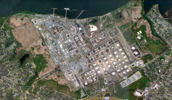
Let’s take a few closer looks – I’m no aerial map interpretation expert, but I’ve been to the site and will make notes.
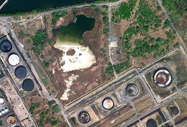
Does that pond look like a healthy swimming or fishing hole? What’s that white crap? Looks like some kind of landfill on the right
That’s Red Bank Elementary School at the bottom left. How’d you like to send you kids to that school? Surprisingly, the thin strip of land between the refinery and the school (300 feet?) was posted as “endangered species habitat”. What kind of critters liketo live amidst toxic discharges? Maybe Coooper’s Hawk has adapted to live there too, as well as in the suburbs! That looks like a pond – wonder if the fish are edible and how the other aquatic life are doing? Were these resources damaged by Sunoco and part of the NRD deal?
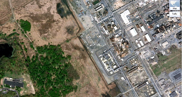
- Here’s what the school looks like from the ground – look closely directly above the dome of the school and see the looming refinery towers. Toxic air emissions are not good for children and other living things!
On lower left, note the wetlands, and stream flowing from the pond to the river. Note the drainage ditch along the perimeter that also discharges to the river. There may be old unlined surface impoundments and lagoons stored toxic liquid hazardous waste on site. These and hundreds of spills and leaks over decades of operation, have led to massive soil and groundwater pollution. I assume that this groundwater pollution and surface runoff from the site are polluting the Delaware and poisoning ecosystems. I wonder what the Baseline Ecological Evaluation and NR damage assessment concluded about all that? How much are those resources worth?
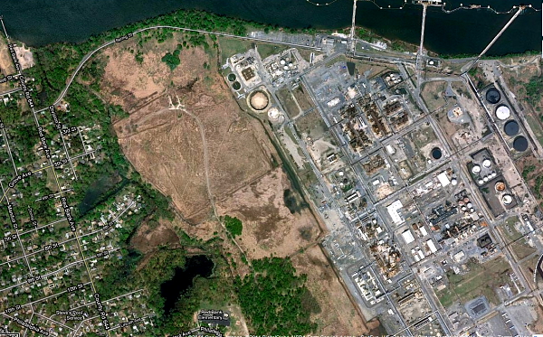
Looks like there are some pretty valuable natural resources and sensitive receptors at the northern perimeter of the facility too. How’d you like to live in that neighborhood?
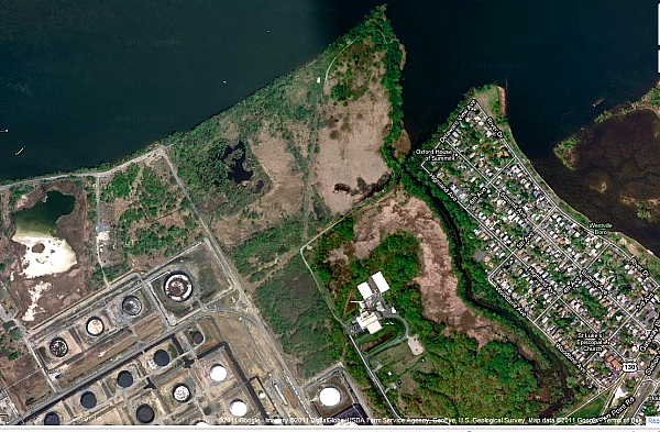
That’s a Farm down there, but it sure don’t look like Old MacDonald’s Farm. Does it look well maintained?
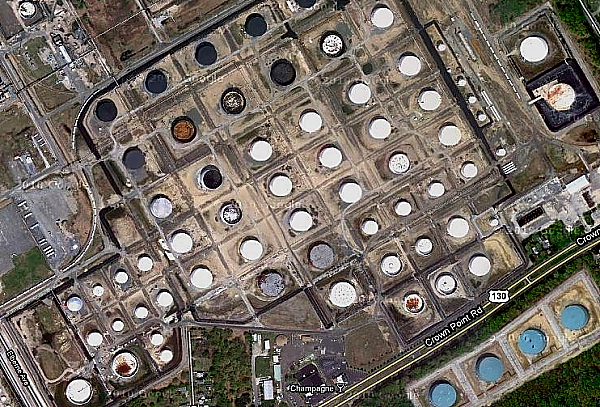
Gee, I wonder what kind of toxic crap is in this tank?
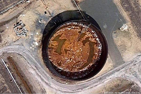
But don’t worry, be happy. The business friendly Christie DEP’s is looking out for you and Bob Martin is treating his “customers” (Sunoco) right! (look at that logo! Wow! The Official Fuel of NASCAR! But that tank in the lefthand background doesn’t look too good).

Pingback: WolfeNotes.com » Sad Week in Trenton
My hope is that anyone who reads your story takes the time to look at these refineries on a mapping website. “That white crap” is sand, it is not covered with water in the picture. Maybe when the water level is higher it will be covered with water, but in the image you provide, and the current images on Google maps, it is not. I guess you never made it to the pond while you were on site?
As for the tank in which you “wonder what kind of toxic crap is in this tank”. If you look at the image, you can see the shadows on the walls and the ladder at a sharp angle. This tank (and several others nearby) are either empty, or near empty. The roof on this tank is not fixed at the top, it can raise and lower with the level of fluid. I suspect the toxic substance in this tank is oil at some stage in the refinement process.
You remember that “thin strip of land between the refinery and the school”? The one that you guess is “300 feet”? Take a look at that school, if the land in between it and the facility is 300 feet, the school can’t be any more than 75 feet long. Basically, by your estimate, the school is less than the length of 2 semi trailers back to back. Using the scale bar on Google maps (the site you obviously used to take these pictures from), it is about 1500 feet, or a little less than a third of a mile between the school and facility. I agree, that still isn’t much, but as there are facilities like this right down the road, and across the river adjacent to Philadelphia, one school doesn’t actually deserve the fervor you seem to have for it.
Thanks for commenting Paul
I have walked that thin strip of land between the refinery and the school.
Yes, it is more than 300 feet, but it does not buffer the school kids from air emissions from the refinery and various disposal operations.
Direct exposure pathway – dust too.
Pingback: شركة تنظيف منازل بجدة
Pingback: Social news magazine
Pingback: WolfeNotes.com » Senator Sweeney’s Block On The Confirmation of Gov. Murphy’s DEP Commissioner Prolongs Gov. Christie’s Anti-Environmental Policy
Pingback: WolfeNotes.com » Murphy AG and DEP Rubber Stamp Christie Pollution Settlement With Big Oil
Pingback: WolfeNotes.com » Murphy DEP Renews Air Pollution Permit For Major Fossil Gas Power Plant – Permit Has No Limits On Greenhouse Gas Emissions