Scores of Trees Tagged For Removal In Central Portion of Island
Tree assessments completed – But where is the DEP plan?
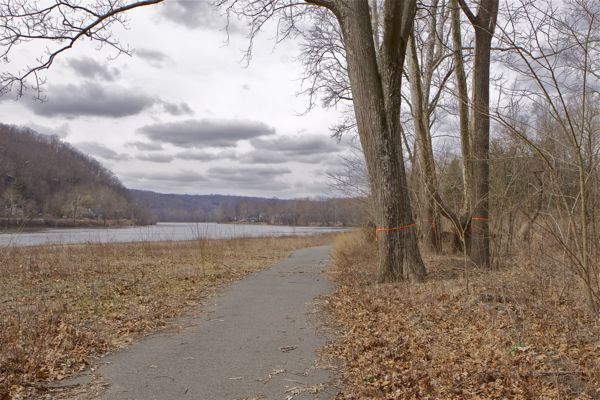
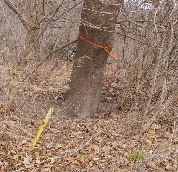
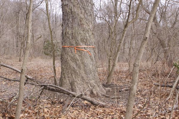
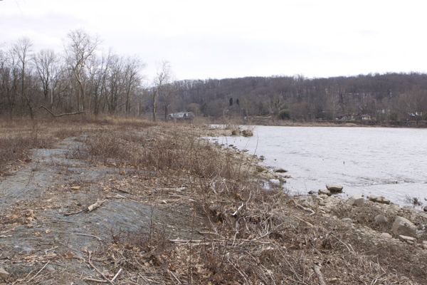
mature oak, ash and clump of sycamores tagged for removal (3/17/13) - DEP will make entire riverfront look like illegally cleared bank on the left.
[Update below]
Here we go again – it looks like DEP learned absolutely nothing from last year’s long battle over a DEP proposed plan to clearcut the northern portion of Bull’s Island State Park.
Recapping that debate: Ecologists severely criticized DEP flawed assessment methodology and lack of a restoration plan. Thousands of people opposed the plan. Several local governments adopted Resolutions opposing the plan. The US Army Corps of Engineers took enforcement action for illegal river fills and destruction of vegetation along the Delaware River, including a stop work order. Hunterdon County took enforcement action for violations of erosion and sediment control laws. The National Parks Service expressed concerns and conducted oversight due to the Wild & Scenic River designation. USFWS and DRBC got involved. There was huge turmoil at the D&R Canal Commission, including current efforts to amend the Master Plan to block DEP’s plan. DEP got tons of bad press.
So, just what does it take to get DEP to change course?
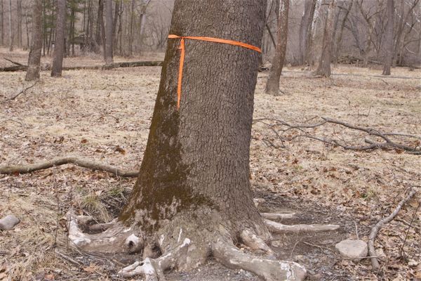
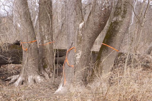
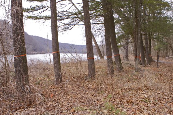
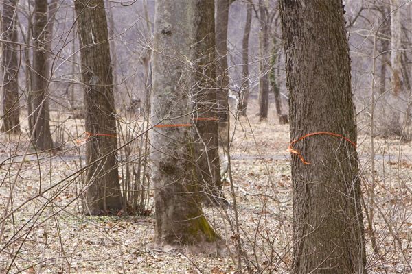
I was out there on Sunday, and noted that over 70 trees in the central portion of the island had root collar excavations and were tagged for removal (assume orange is cut, yellow ribbon is keep).
Late last sumer, DEP did distance themselves somewhat from the initially proposed clearcut plan, but never made any firm commitments on the northern portion or the central portion either.
I had planned to go to the D&R Canal Commission meeting tomorrow (March 20) to find out the current status and whether DEP ever submitted a plan, as promised last summer.
But I just got an email advising that the Commission meeting was cancelled due to a lack of a quorum and the next meeting is April 17.
DEP website has not been updated for months, and still says this:
The Department of Environmental Protection (DEP) is in the process of developing a comprehensive management plan for the Bull’s Island Recreation Area upper river camping section, which includes hazardous tree removal and reforestation. The upper river campground/low lying area campsites are closed for public access until the area can be reopened for passive recreational use. The down river campsites are closed for the 2012 camping season pending a second phase tree assessment which will be conducted over the summer. Day use activities in the lower river section, including the boat ramp and picnic area remain open.
The DEP conducted a tree assessment of the entire upper river campground as a result of a large sycamore falling in 2011. The assessment provided evidence of hazardous trees due to root decay from silt buildup related to repeated floods. Most of the trees in the area were found to have compromised root systems.
As a result, the DEP closed all camping areas to protect the public. For the upper river campground which consists of a 5 acre parcel with more than 200 large trees, a management plan is in development to mitigate the public safety hazards with the goal of eventually reopening the area to the public for passive recreation. The management plan will include the removal of trees in the upper river camping area and replanting of the area with smaller growing trees, shrubs and other native vegetation. To adequately refine this management plan and to ensure that impacts of the tree removal to the natural resources, including migratory and nesting birds and other wildlife, are minimized, a coordinated team representing the various technical programs within the DEP are providing input to ensure concerns are addressed and any necessary reviews are conducted and appropriate permits obtained. Plant material that will thrive in this type of environment and not create hazards for public access will be the focus of the plan, with attention to monitoring for, and controlling invasive species. The area will ultimately reopen for passive recreational use. The DEP will make a decision on the lower river camping section once the tree assessment is completed.
The tree assessments have been completed for some time and trees tagged for removal.
But where is the DEP plan?
[Update 3/20/13 – I’ve been advised that the tree ribbons may not be for removal but could be to identify trees that need additional assessment work and that DEP may have asked the consultants to do additional work and collar assessments to justify tree cuts.
I had the same thought, but that doesn’t really matter.
The critical point is, that DEP should not be digging in and having consultants spend more time and money better justifying tree cuts.
DEP’s sole justification for any tree cuts are to re-open the middle portion of the island for camping. There are alternative camping locations. Even if there weren’t, the camping use is far less value than the preservation of trees and habitat.
The best use of the park is for DEP to designate the entire island a Natural Area, for conservation and passive recreation (the southern half of the island is currently designated a Natural Area).
Any technical work right now should be in transitioning to a natural area, preparing an ecological restoration plan, and developing the technical basis for that.
Restore this!

Pingback: youngest nfl players
Pingback: fitflop soldes
Pingback: yPxACrJH
Pingback: Roger Vivier shoes
Pingback: hollister lyon
Pingback: louis vuitton norge
Pingback: fitflops norge
Pingback: WolfeNotes.com » Too Old To Tolerate The Lies